Geographic Consultancy Solutions
From detailed site surveys to comprehensive regional assessments, our services address the full spectrum of geographic analysis needs across the United Kingdom.
Topographic Surveys
Our topographic surveys capture the precise elevation, contours, and physical features of your site. Using a combination of total station measurements, GPS positioning, and aerial photography, we produce detailed maps that form the foundation for planning applications, engineering projects, and environmental assessments. Each survey includes comprehensive data on gradients, drainage patterns, and existing structures.
- Contour mapping
- Spot heights
- Feature identification
- CAD deliverables
- Site photography

Watershed Analysis
Understanding how water moves across and through a landscape is essential for flood risk assessment, sustainable drainage design, and environmental impact studies. Our watershed analyses delineate catchment boundaries, map drainage networks, and model flow accumulation patterns. We integrate historical flood data with contemporary terrain models to provide comprehensive hydrological assessments.
- Catchment delineation
- Flow direction mapping
- Flood risk assessment
- Channel analysis
- Infiltration zones

Terrain Modelling
Our digital terrain models transform raw elevation data into three-dimensional representations that reveal landscape characteristics invisible in two-dimensional maps. These models support viewshed analysis, slope stability assessment, and visual impact studies. We deliver models in formats compatible with major GIS platforms and can produce custom visualisations for stakeholder presentations.
- 3D surface models
- Slope analysis
- Viewshed mapping
- Cross-sections
- Animation renders

Land Use Assessment
Our land use assessments combine field surveys with historical map analysis and aerial imagery interpretation to document current site conditions and trace patterns of change over time. These assessments support planning applications by establishing existing use characteristics and identifying environmental sensitivities that may constrain development proposals.
- Current use mapping
- Historical analysis
- Boundary verification
- Constraint identification
- Planning context
Cartographic Services
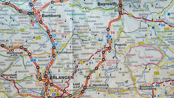
Clear, accurate maps communicate geographic information effectively to technical and non-technical audiences alike. Our cartographers produce bespoke mapping products ranging from detailed site plans to regional overview maps. We work with clients to develop visual styles that convey information clearly while meeting publication standards for reports, applications, and public consultations.
- Custom styling
- Print-ready output
- Digital formats
- Legend design
- Scale flexibility

Regional Planning Consultancy
For large-scale developments and infrastructure projects, our regional planning consultancy integrates multiple geographic analyses into cohesive strategic assessments. We work with planning authorities, developers, and infrastructure providers to understand landscape-scale constraints and opportunities, informing decisions that shape communities for generations.
- Strategic assessment
- Multi-site analysis
- Infrastructure planning
- Stakeholder liaison
- Policy integration